Black Mesa (Dził Yíjiin) Cartography Map
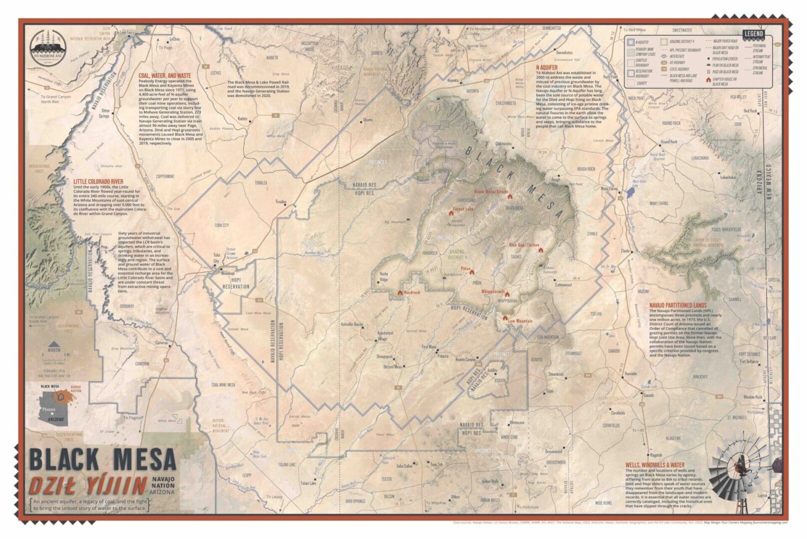
In 2024 Tó Nizhóní Ání embarked on a media mission to create the Black Mesa region’s first ever cartography map. Created in partnership with Four Corners Mapping & GIS, this map is more than just a reference—it’s an invaluable resource for Black Mesa. This map will give viewers a glimpse into rural Black Mesa living, which navigates the region’s remote roads and visualizes interconnected water systems and the various overlapping boundaries as we advocate for our rightful access to water. Our goal with this map was to consolidate the various data found within our communities and at the Navajo Nation level for easier access and viewing. Please note that there is data lacking such as accurate water sources on Black Mesa as well as different entities having varying data like Chapter boundaries.
On Wednesday, March 12, 2025, Tó Nizhóní Ání team members joined Anna Riling with Four Corners Mapping & GIS and 25th Navajo Nation Council Delegate Germaine Simonson for a webinar to discuss the various parts of the Black Mesa Cartography Map. TNA executive director Nicole Horseherder spoke about the Black Mesa Coal Industrial Complex, and Adrian Herder discussed the Chapter Houses/Boundaries, Grazing District 4, Reservation and County Lines. Council Delegate Germaine Simonson spoke on the Black Mesa region’s Navajo Partitioned Lands, Major Roads, and Landmarks. Lastly, TNA community organizer Andrew Atencia talked about the Navajo Aquifer and the waterways on Black Mesa.
Presenters:
- Nicole Horseherder, Tó Nizhóní Ání
- Anna Riling, Four Corners Mapping & GIS
- Delegate Germaine Simonson, Navajo Nation Council
- Andrew Atencia, Tó Nizhóní Ání
Host/Tech Support:
- Adrian Herder, Tó Nizhóní Ání
- Raeanna Johnson, Tó Nizhóní Ání
How can I get a copy?
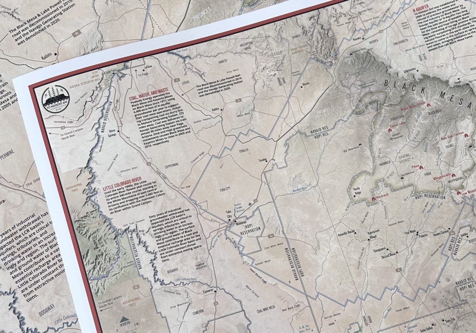
Consider donating $30 to our organization to receive a 16x24 inch physical copy of our Black Mesa Cartography Map (shipping and handling included). Your support is critical to our organization. Your donation will help benefit youth programming, community projects/education, and the continued work of water protection on Black Mesa.
Follow the link below to make a donation. At check-out, please note "Black Mesa Map" and your preferred mailing address. For questions, please email Adrian@tonizhoniani.org
Notable Achievements


About the Cartographer:
![Four Corners Mapping and GIS[53]](https://tonizhoniani.org/wp-content/uploads/2025/02/Four-Corners-Mapping-and-GIS53.png "Four Corners Mapping and GIS[53]")
Four Corners Mapping and GIS is a woman-owned business based in Durango, Colorado. Four Corners creates custom cartography for policy advocacy campaigns and print media, designs interactive web mapping applications and ArcGIS Story Maps, and produces geologic and topographic trail maps.
Learn more: www.fourcornersmapping.com